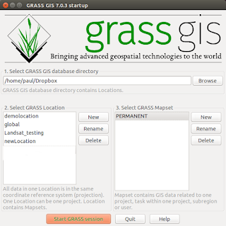
Opening a Map on the GRASS GIS command line (Ubuntu Users)
With some quick keying in skills (unlike mine) you can open GRASS GIS, set the region of interest, display a map with an ordnance survey grid change the colour table of the map and add a scalebar and legend. Why not try it yourself with one of your maps and substitute 'mosaic' with your own map name.
g.region rast=mosaic -p;d.mon wx0;d.rast mosaic;d.grid size=10000;r.colors mosaic col=gyr;d.redraw;d.barscale at=5,90;d.legend mosaic at=70,15,5,10- Open a terminal (Ctrl+Alt+T)
- Type 'grass70'
- Grass GIS will open
- Type:-
#then press 'return' key#
Remember when one process follows after another MMP; - Module Map Parameter;Module Map Parameter;Module Map Parameter;
https://drive.google.com/file/d/0BwWaeb1nDyejaERNd0poQzZORXc/view?usp=sharing
Comments
Post a Comment