Posts

Showing posts from 2015

Opening a Map on the GRASS GIS command line (Ubuntu Users)

With some quick keying in skills (unlike mine) you can open GRASS GIS, set the region of interest, display a map with an ordnance survey grid change the colour table of the map and add a scalebar and legend. Why not try it yourself with one of your maps and substitute 'mosaic' with your own map name. Open a terminal (Ctrl+Alt+T) Type 'grass70' Grass GIS will open Type:- g.region rast=mosaic -p;d.mon wx0;d.rast mosaic;d.grid size=10000;r.colors mosaic col=gyr;d.redraw;d.barscale at=5,90;d.legend mosaic at=70,15,5,10 #then press 'return' key# Remember when one process follows after another MMP; - M odule M ap P arameter ;M odule M ap P arameter ;M odule M ap P arameter ; https://drive.google.com/file/d/0BwWaeb1nDyejaERNd0poQzZORXc/view?usp=sharing
QGIS User Group (Wales) 6th October 2015

It's a pleasure to be asked to speak at this event. Who would have thought that Wales (UK) would be one of the first areas to acknowledge there are perfectly good (and free) alternatives to the big player. Finally, the message is out there. Lets hope it's an even bigger event in 2016. Processing Landsat 8 Multi-Spectral Images with Grass Tools & the potential of the 'QGIS-GRASS-PLUGIN'

Install GeoServer on Ubuntu 15.04 (localhost)

Image
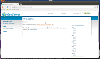
It's quite easy to find installation instructions for most Ubuntu versions but it's nice to check they still apply to the most recent release (15.04 at the time writing). I tested this yesterday and it still works for me. My thanks to Hongru Hou (link at the end of the article for full details). Install Apache2 (if not installed):-   sudo apt-get install apache2   sudo apt-get update Test Apache2 web server is working:- sudo /etc/init.d/apache2 start sudo /etc/init.d/apache2 stop sudo /etc/init.d/apache2 restart Install Java 7 using the 'Webupd8team' repository:- sudo add-apt-repository ppa:webupd8team/java then:- sudo apt-get install oracle-java7-installer   (takes about 10 minutes to download) Install Tomcat7 (because it is GeoServer Web archive this replaces the missing Java Servlet of this edition)   sudo apt-get install tomcat7 then in order for tomcat7 to find JDK we need to open and amend one line:- sudo vi /etc/default/tomcat7  JAV

Landsat 8 getting data the easy way

My thanks to Gregor Maclennan on the PPGIS forum for this link. I've been using Earth Explorer for years but this is simple, clean and no nonsense. http://libra.developmentseed.org/

European Space Agency - Sentinel-2A/2B and the Copernicus Programme

Briefly The Sentinel-2 mission comprises ‘twin polar-orbiting’ satellites in the same orbit phased at 180 degrees to each other. The purpose of the mission is to detect variabilities in land surface conditions with a high revisit of 10 days with one satellite (2A), (5 days with two constellation)(2B). The coverage limits are between latitudes 56 degrees south and 84 degrees north. Sentinel-2 will sample 13 spectral bands including 4 bands at 10m spatial resolution, these are B2 (490nm), B3 (560nm), B4 (665nm) and B8 (842nm), 6 bands at 20m spatial resolution, these are B5 (705nm), B6 (740nm), B7 (783nm), B8a (865nm), B11 (1610nm), B12 (2190nm) and finally 3 bands at 60m spatial resolution, these are B1 (443nm), B9 (945nm) and B10 (1375nm).  These twin satellites will provide continuity of SPOT and LANDSAT type images for applications which include Land Management, Agriculture, Forestry, Disaster Control, Humanitarian Relief Operations, Risk Mapping and Security Operations

How to install Postgresql-9.3.5/9.4 and PostGIS-2.1 on Ubuntu 15.04 in six easy steps.

Install Ubuntu 15.04 (Vivid Vervet) 1. check your Ubuntu version:- lsb_release -a Install Postgresql 2. On the server or your PC (Terminal):- sudo apt-get update sudo apt-get install -y postgresql postgresql-contrib Create a database and a user for access Replace DATABASE_NAME_HERE and USER_NAME_HERE with the values you want to use. # this will prompt you for a database password...also note the capital letter 'O' not number '0' (zero) below:- 3. sudo -u postgres createuser -P USER_NAME_HERE sudo -u postgres createdb -O USER_NAME_HERE DATABASE_NAME_HERE Test Connection to Postgresql 4. psql -h localhost -U USER_NAME_HERE DATABASE_NAME_HERE Postgresql will ask you for your password. Then you should see the following: psql (9.3.5) SSL connection (cipher: DHE-RSA-AES256-SHA, bits: 256) Type "help" for help. DATABASE_NAME_HERE => To exit type:- \q To add PostGIS-2.1 support to the database 5. sudo apt-

Google Earth Pro is (according to slashgeo) about to be free.

'Slashgeo.org' have just posted a new entry siting the following:- "The Google Earth Blog (independent from Google) found out that  Google Earth Pro is now free, it was formerly $400 per year. There hasn’t been an official announcement yet, but as pointed out by a GEB reader,  “the Google Earth licence support page for languages other than English states that from January 20th, 2015 the licence is free.”  The GEB languages other than English list some features available in the Pro version not available in the Free version:  “Although many of the extra features found in Google Earth Pro will only be useful to GIS users, a few features that our readers have expressed interest in using are: the built in movie maker, area and perimeter measurements and the ability to turn off terrain completely.”   You’ll find more details about what the Pro version has to offer on the Google Earth Pro official webpage. Wikipedia lists GIS data importation and advanced printi

QGIS Mobile is dead...long live 'QField'

QGIS has become one of the most successful Open Source GIS projects on the planet. From it's early beginnings as not much more than a Shapefile viewer to an ArcGIS alternative coupled with Grass GIS Modules there is very little general spatial functionality missing... well almost. QGIS was never meant to be a convenient field data entry tool and QGIS for mobile was meant to fill the gap however as of December 2014 the project has been refocused to create a touch optimised interface aimed at field work using the QGIS libraries. 'QField' aims to take your pre-prepared QGIS project out into the field and maintain QGIS styling. Some of the promised tools include:- More GPS centric editing. Desktop compatibility. Synchronisation. Project preparation on QGIS Desktop. Simple interface with just a couple of buttons. Switchable use paradigm Built from Qt5, QtQuick 2 and OpenGL. For a proposed list of functions click here . #document