Is technology getting in the way of the main objective? That server is down again!
Have you noticed what has happened to GIS in the last five years? It has become a mammoth task
to do (essentially) the same thing that we were doing fifteen years ago.
That is to disseminate data for users to use and manipulate, only now the technology is so much more complex that potential new users have not only lost interest but the costs and workloads have
escalated out of all proportion requiring an new intermediate breed of specialists and
consultants each with their own idea of
what the end user 'really' needs based on solutions which previously worked for financial, banking and payroll systems.
If I want data I don't care how I get it and in whatever format is available in so long as I can 'find' it, 'download' it and 'translate' it, tools that are present even in the most basic GIS package. Now I cannot 'find' it unless I know the correct search term and the correct 'Portal' I cannot 'download' it unless I register and the system accepts my sixth attempt at getting the password correct, I then have to answer a series of pointless questions to ascertain my status and 'accept' allowing the portal to send me more junk mail than i can delete from my google account in 30 minutes.
There seems to be a 'Portal' for just about everything and anything all requiring 'usernames' and 'passwords' the technology has become the problem instead of the objective adding layers of added complexity along the way. I now need an 'infrastructure' a 'service' a 'search engine' and associated server software and middle ware support from the I.T. department.
All I need is software and data that's current and accurate. I don't have time for all the other 'stuff' I'm a GIS user I input, manipulate and display data to answer my problem, I need to see the spatial correlations, the patterns, the visual maps and I need user control to carefully define my message. I've lost simplicity and gained more complexity but hey that's progress I'm sold.
The end result is usually (as always) a customised, printed map or a PDF the same thing we were doing fifteen years ago.
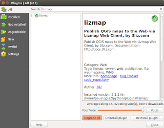
But... hang on there could be a saviour 'QGIS Cloud' publish a complete QGIS project with a couple of clicks and let the service provider worry about the rest.
maybe some things are better than they were fifteen years ago!
If I want data I don't care how I get it and in whatever format is available in so long as I can 'find' it, 'download' it and 'translate' it, tools that are present even in the most basic GIS package. Now I cannot 'find' it unless I know the correct search term and the correct 'Portal' I cannot 'download' it unless I register and the system accepts my sixth attempt at getting the password correct, I then have to answer a series of pointless questions to ascertain my status and 'accept' allowing the portal to send me more junk mail than i can delete from my google account in 30 minutes.
There seems to be a 'Portal' for just about everything and anything all requiring 'usernames' and 'passwords' the technology has become the problem instead of the objective adding layers of added complexity along the way. I now need an 'infrastructure' a 'service' a 'search engine' and associated server software and middle ware support from the I.T. department.
All I need is software and data that's current and accurate. I don't have time for all the other 'stuff' I'm a GIS user I input, manipulate and display data to answer my problem, I need to see the spatial correlations, the patterns, the visual maps and I need user control to carefully define my message. I've lost simplicity and gained more complexity but hey that's progress I'm sold.
The end result is usually (as always) a customised, printed map or a PDF the same thing we were doing fifteen years ago.
But... hang on there could be a saviour 'QGIS Cloud' publish a complete QGIS project with a couple of clicks and let the service provider worry about the rest.
maybe some things are better than they were fifteen years ago!


Comments
Post a Comment