Posts

Showing posts from February, 2012

A Simple Tutorial On GUI Programming Using Qt Designer With PyQt4

A Simple Tutorial On GUI Programming Using Qt Designer With PyQt4

QGIS/GRASS Tutorial - Vectorising Surface Heights of between 28 and 53 metres from lidar.

Image
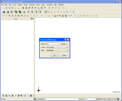
There are advantages for using raster data over vector, any 'continuous' varying coverage is far better displayed as a raster or (pixel grid). The height data I'm using is low resolution lidar. One advantage of converting from raster to vector is that you can add columns to your data attribute table for further analysis at a later date. You can do some of this analysis with the GRASS Module (r.mapcalc) if you wish to stay with raster data. Step 1.      Open the GRASS Mapset which contains your lidar (raster) grid data (as above). Step 2.      Load your small area of data onto the QGIS canvas (above). Step 3.      In the GRASS Module List search for 'r.to.vect.area' , 'INPUT' file = 'testascii' , 'OUTPUT' file = 'testascii_vectorised' . I've always found it useful to name the output files with some indicator to which module or description was used to produce it. Step 4.      When we open the attrib

GDALWARP - How to import a large number of Arcinfo Ascii Grid files into Grass GIS

Image
I  recently downloaded around a 1000 Arcinfo Ascii Grid files and wanted to import them into Grass GIS. My first thoughts were to use the 'r.in.gdal' module wxGUI (of course) but this wouldn't allow me to import all the files in one go. Then i tried the 'r.in.arc' module but again this only seemed to want one file at a time. Thanks to Markus Neteler for this solution...The 'GDALWARP' utility!. Step 1. In the command line navigate to the folder containing your '*.asc' files.   Step 2. Type the following: gdalwarp --config GDAL_CACHEMAX 8000 -wm 8000 *.asc mosaic.tif The processing of each file should follow this format on the command line as above. Job Done. An image entitled 'mosaic.tif' will have been created in the same directory. Step 3. Simply import the 'mosaic.tif' into Grass GIS. Apply your own colour table as necessary.